By Chris Spangler
The Fort Atkinson Plan Commission has advanced the first phase of multifamily housing planned for the city’s northwest side.
Ryan Quam is developing two apartment buildings at 1310-1320 Campus Drive on land owned by Tip of the Spear LLC.
He plans to construct two four-story, 36-unit apartment buildings on the site, which was annexed to the city last year and is in the new Tax Increment District No. 9. The units will be a mix of one-bedroom, two-bedroom and two-bedroom-plus-loft apartments, with both underground and surface parking.
The primary access road will be off Campus Drive. Construction of the first building will begin this summer.
On Tuesday, the Plan Commission approved a certified survey map (CSM), rezoning and a Specific Implementer Plan (SIP) for the first phase of the housing project.
City engineer Andy Selle explained that the certified survey map is under the process of a Planned Unit Development (PUD).
“The PUD process is going to be composed of the CSM, … where we’re going to combine two lots into one, and once we have that lot delineated, we will be rezoning that lot to the PUD zoning,” he said. “The PUD zoning allows the Plan Commission, as well as the city council, to obtain some flexibilities to our current zoning code that allow us to, exactly that, be flexible for types of projects that are coming in that are certainly an asset to the community, but may require some changes to the zoning code.”
He said those changes will be summarized in the General Development Plan (GDP), so when the property is rezoned to the PUD, the city also will accept the GDP and those flexibilities.
The third step, he said, will be the Specific Implementation Plan (SIP) review, which essentially is a site plan review that considers landscaping, aesthetics and the like.
Selle reported that the certified survey map combines two lots into a single lot, and that city staff have reviewed it with no concerns.
Commissioner Loren Gray made a motion recommending that the city council accept the certified survey map. This was seconded by Commissioner Jill Kessenich and unanimously approved.
Commissioner Davin Lescohier was absent from the meeting.
As for the rezoning, Selle said the current zoning is Single-Family Residential (SR-2), and the proposal calls for two buildings constructed in two phases, though the first phase is being addressed now.
Rezoning the property to Multifamily Residential (High Density) or MRH-30 requires a number of things to which the project already complies. There are a few exceptions, though.
“I should note that the pavement setbacks for this project are met because this is not a public road up here along the high school parkway,” Selle said, referring to the north-south school driveway.
However, the city is in discussions with the School District of Fort Atkinson to make that a public road.
“So, we are going to include a flexibility for varying that setback in that area … The reason for that the (water) retention basin that is immediately to the east of this particular building is required on the site and that puts the building a little too close to the overflow or flood elevation of that,” Selle explained.
The second flexibility is related to the building height. The MRH-30 limits it to 45 feet, but the structures will measure 51.25 feet in height due to the underground parking garage.
Also, the garage setback code states that garages be situated two feet from the principal structure. However, this essentially is waived due to there being underground parking.
“All three of these flexibilities, from the staff’s point of view, are relatively minor,” Selle told the commission.
Gray asked whether anyone had received comments or questions from the public about the project, and he was told no one had. Selle said the school district views this as a positive effort.
City Manager Rebecca Houseman LeMire said that the town of Koshkonong clerk was notified of the plans, as the land across Banker Road to the east is in that town.
“The General Development Plan also will come before city council for review by that body. The SIP is only approved by the Plan Commission; it will not go to the city council,” Selle said.
Gray made a motion recommending that the city council consider rezoning this site to the PUD GDP with the three exceptions noted. This was seconded by Commissioner Eric Schultz and unanimously approved.
The commission then considered the SIP.
“As I mentioned, the SIP really is akin to the site plan review you’re used to seeing at the Plan Commission,” Selle said.
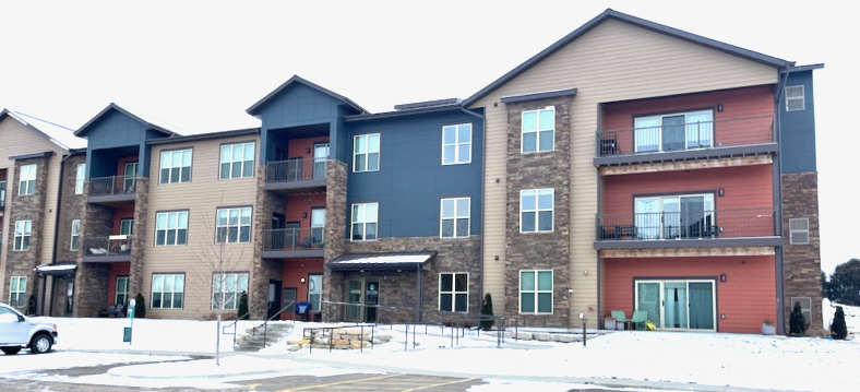
He showed a photo of a similar building in McFarland constructed by the developer, although it was three stories instead of the four proposed for Fort Atkinson. He said the color scheme and general layouts along the facades are consistent with the planned project.
“The site plan itself was reviewed against the zoning code. There’s the three flexibilities we mentioned earlier and have approved — that being the pavement setback, the attached garage setback and the flexibility for the building height. Everything else that’s proposed on the site for phase one meets the zoning code and we have no concerns,” Selle said.
He said all of the city staff reviewed the plan with just a few comments.
As city engineer, he reminded the commission that there will be traffic impacts from not only this development, but from another one just to the north.
Hoffman Development Group LLC and CedarPrise LLC plan to build three four-story buildings consisting of a total 141 apartments.
“The city has engaged a traffic impact analysis with Graef consultant that has some expertise as such in Fort Atkinson,” Selle said. “They are beginning their data collection on Monday and will have some results for us probably within the next month. So we will be well ahead of any potential impacts to traffic within this area.”
He said the first phase of Tip of the Spear is not expected to impact traffic.
“As we continue to build with this development and additional developments, that is when we want to make sure that we’ve planned ahead for any changes or management decisions that need to be made,” Selle said.
He also mentioned that Quam provided a letter from the state Department of Natural Resources stating that there is an opportunity for some limited filling of the wetlands on the property to accommodate the development.
In addition, Selle noted that the fire department had requested a review of access.
“We looked at the largest piece of equipment, which is the ladder truck. The ladder truck can get into this particular area, but there is an addition on the west side of the development or the high school access for a temporary access. The thought is if we do, in fact, need the ladder truck to come into this area, we would like to be able to pull through. Currently under phase one, without that temporary access off of the high school driveway, we do not have that ability,” the city engineer told the commission.
Selle said that access drive would be gated so it would not be available for use by the tenants or public, but will allow the fire department to enter if necessary.
“In phase two, I think that will be changed either to a permanent access at that location or perhaps at another location along that high school driveway,” he added.
Selle also mentioned that during the concept plan phase, Kessenich had voiced concern about saving a large pine tree on the property. Quam has done that, and the developer also is trying to accommodate several large oak trees.
“We’ve had discussions about pushing the building further to the north to kind of catch these oak trees within parking areas and parking bumpouts so we can preserve those monument trees along the site,” he reported.
He also said the city asked that the Campus Drive frontage be set back a little further with berms or an aesthetic landscaping feature to break up the parking lot in front of the building.
In addition, the city requested that sidewalks be added to the full length of the Campus Drive frontage as soon as occupancy is allowed. Curbing around the parking areas is waived due to elevation. The city will continue talks with the fire department regarding the truck access.
Gray asked what possible changes could be made to the streets or traffic pattern following the traffic study’s findings.
“With phase one, 36 units, we may see very little,” Selle said. “The one intersection now that concerns me a bit is the Banker Road and Madison Avenue intersection, specifically the left turn out of that intersection, so if you’re facing south on Banker Road trying to turn left onto Madison Avenue. That’s an area that’s been on our radar for a bit and it’s something the staff has talked about, potentially eliminating that left turn there. The TIA (traffic study) will take a look at that and I would not be surprised if an immediate suggestion is that we do eliminate that left turn.”
He continued: “My expectation beyond that is as we grow in density here, we’ll see that we may need some additional intersection control that’s not at Lexington and Madison Avenue. That will kick in if the school district ever decides to move a middle school into the area and we would have a vacation potentially of Campus Drive. Then we would have a difficult time getting all of these residential folks over to a controlled intersection. So I could see taking the controlled intersection at Lexington and moving it to Banker.”
Gray asked how southbound traffic on Banker Road would be able to turn left onto Madison Avenue. Selle said vehicles would take Campus Drive to Lexington Avenue.
“As long as Campus Drive remains open, I think the traffic impacts are going to be fairly minor. But at that point if, as I said, the middle school is located in this area and we do end up vacating Campus Drive, access to that controlled intersection is limited for all this residential development,” Selle said.
LeMire noted that the development will return with an SIP for phase two. Also, she said Quam has requested TIF assistance with financing, which is moving forward through a path that includes the Economic Development Commission and city council.
Gray moved approval of the SIP subject to the conditions set by city staff. This was seconded by Kessenich and unanimously approved.
Also Tuesday, the commission unanimously approved:
• A site plan review for new signage for Home Backup Systems LLC, 615 Madison Ave.
Selle said this is a single back-lit sign on the north side of the building facing Madison Avenue.
“Every business is allowed a minimum of 40 square feet of wall signage regardless of the facade length,” he explained. “They are meeting that. It is backlit, as I said, but it will have an automatic timer for this area so that the lit sign can be turned off at the end of business hours, seeing that it is facing a residential business.”
He noted that this is the final step in building improvements done on the exterior last summer.
• A site plan review for signage for MBE CPA at 1507 Madison Ave.
Selle said this is the former Verizon store in the mall behind Culver’s Restaurant.
“They also are doing the group sign panels in the existing group sign along Madison Avenue in front of Pick ’n Save. Those are determined on the allotted signs that are already there,” Selle said.
“I think this is great that this will be occupied once again,” Kessenich said of the building. “It’s a very positive thing for this area.”

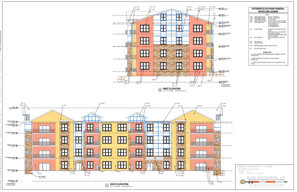
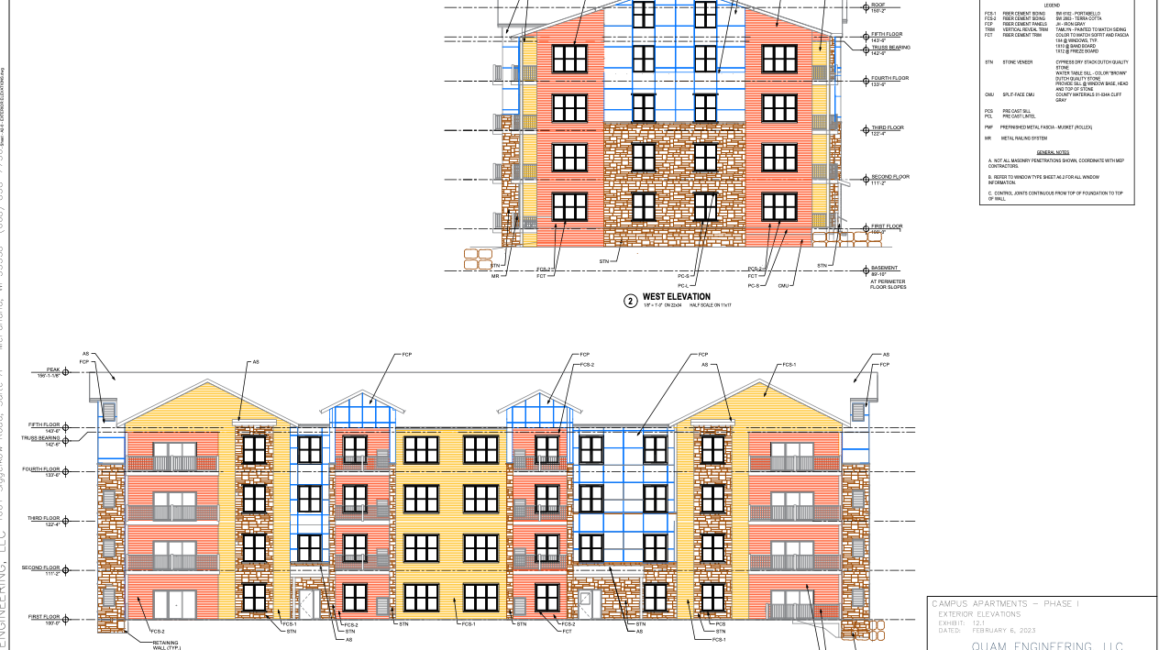
An artist’s rendition shows construction plans of a proposed multifamily building on the city of Fort Atkinson’s northwest side. The rendition, showing the first building to be developed as part of phase 1, and as developed by Quam Engineering LLC, was shared Tuesday with Plan Commission members. The depiction shows the west, at top, and south, above, elevations of the building.

A photo of a similar building erected in McFarland, as shared with Fort Atkinson Plan Commission members Tuesday, shows a three-story construction. The building which will be erected in phase 1 in Fort Atkinson will be four stories. Fort Atkinson engineer Andy Selle told Plan commissioners Tuesday that the example offers an understanding of color schemes and general layout that “are consistent with the planned project” in Fort Atkinson.
This post has already been read 3659 times!
