By Kim McDarison
The Fort Atkinson City Council has begun a process to adopt amendments to the city’s comprehensive plan, official map, and code regarding land division and development.
During Tuesday’s city council meeting, City Engineer Andy Selle brought before council a resolution establishing public participation procedures for the amendment process, followed by the first readings of three proposed amendments to city code, including: an ordinance to adopt amendments to the comprehensive plan, an ordinance to amend the official map, and an ordinance to amend the city’s land division and development code.
All four items — the resolution and first readings of the three proposed amendments — garnered approval Tuesday night. Second readings of the three proposed amendments are slated for the council’s next meeting on Feb. 1.
Ordinances and amendments that change them are required to undergo three readings unless council waives them.
Council approved the resolution putting in place the public participation process.
Comprehensive plan, official map
Selle said changes to the city’s comprehensive plan and official map had been presented to the city’s Plan Commission earlier this month. The commission received the information for informational purposes only.
Additionally, Selle noted that state statutes require that changes made to the city’s comprehensive plan must be consistent with changes made to the official map.
Sharing some background, Selle noted in a memo to council that the three documents addressed within the proposed ordinances, including the City of Fort Atkinson Comprehensive Plan and Zoning Code, each of which were last updated in 2019 and 2020, respectively, and the Land Development and Division Code, which is under review this year, had been part of an initiative made by the city to “revise its suite of planning documents over the last several years.”
Further, he wrote: “The city is also engaged in repealing and recreating the official map, which allows the city to identify appropriate locations for future public infrastructure within and beyond the city’s borders.”
Outlining changes proposed to components of the city’s official map, Selle noted the following:
• Reevaluation and relocation of several proposed future off-street trails, on-street bicycle facilities, wells, parks and roads.
• Removal of outdated elements regarding future locations of a new hospital and the previously planned U.S Highway 12 Bypass.
• The addition of a future airport expansion and State Highway 26 overpass.
• An update to the city’s municipal boundary to reflect the existing boundary.
Public participation process
Pointing to the adoption of a public participation process, Selle said the following steps had been taken or planned, including:
Jan.1: Publication of an upcoming public hearing was posted in the city’s official paper of record.
Jan. 11: The city’s Plan Commission was introduced to the amendments and adoption of the public participation plan.
Jan. 18: Tuesday’s meeting served within the process as the introduction of the amendments and public participation plan to the city council.
Feb. 1: A public hearing about the comprehensive plan and proposed amendments will be jointly held by the city council and plan commission.
An earlier story about proposed changes to the city’s comprehensive plan and official map, as it was presented during the Jan. 11 Plan Commission meeting, is here: https://fortatkinsononline.com/commission-offers-potential-updates-to-citys-official-map-comprehensive-plan/.
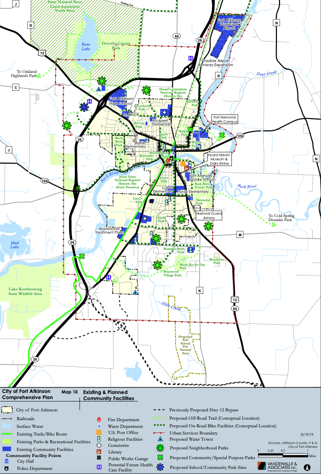
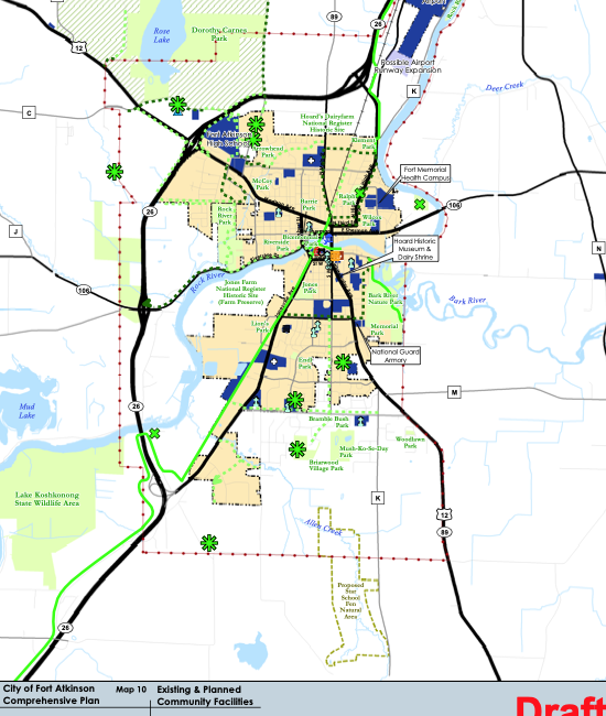
The graphic above shows the City of Fort Atkinson “Map 10,” depicting existing and planned community facilities as created in 2019.
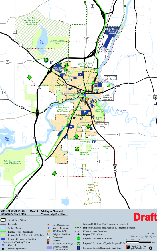
A view of Map 10 shows proposed mapping changes.
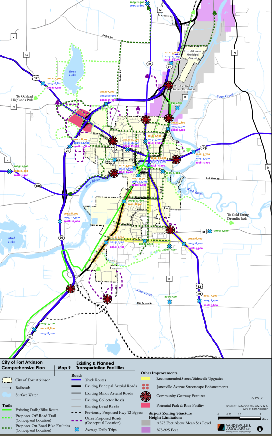
The graphic above shows the City of Fort Atkinson “Map 9,” depicting existing and planned transpiration facilities as created in 2019.
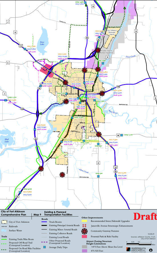
A view of Map 9 shows proposed mapping changes.
This post has already been read 2426 times!
