By Kim McDarison
Twelve tornados, according to the National Weather Service, touched down in southern Wisconsin last Thursday. All were rated using the Enhanced Fujita scale (EF) at EF-0 or EF-1, the lowest levels on the six-level scale.
The scale rates tornados based on the ferocity of the wind gusts they produce. The lowest rating, EF-0, is defined by wind gusts of 65 to 85 miles per hour. The highest rating, EF-5, brings winds gusting to over 200 miles per hour.
A link explaining the Enhanced Fujita scale is here: https://www.weather.gov/oun/efscale.
The EF-0 and EF-1 ratings of Thursday morning’s storms were somewhat predictable, Janesville native and storm chaser Tom Purdy said.
Awakened late last Wednesday night by the weather app on his cell phone, alerting him that storms were moving through the area, he said he looked at the radar.
Usually eager to photograph tornados, Purdy said storms produced by a system traveling across portions of Jefferson, Dane, and Waukesha counties Wednesday night and early Thursday morning were “nocturnal,” making them harder to spot, and, therefore, more dangerous.
He described the line of storms as a “quasi-linear convective system.”
With those types of lines, he said, “you have pockets of rotations, so there are a lot of brief touchdowns, but generally, there are not violent tornadoes that form in a line like that.”
Such systems are “an ordinary late summer occurrence,” Purdy said, adding: “It seems so odd this year because we haven’t had storms. Wednesday’s storms were our first significant event of the year.”
In Wisconsin and the Midwest, he said, storms usually begin in March and April.
For Purdy, a lack of storms is “absolutely disappointing.”
A storm chaser for the last 10 years, he said he was afraid of storms as a kid, but today he photographs them for their beauty.
Learning about storms
Purdy said he wasn’t always so eager to confront summer storms. During his childhood, they often moved through Janesville and he was afraid.
A 1999 graduate of Janesville’s Parker High School, Purdy said, as an adult, in 2010, he took a two-hour weather-spotting course offered by the National Weather Service.
Not long after completing the course, he was invited to travel with another spotter by car to South Dakota. The purpose of the trip was to attend a party, Purdy said, but as circumstances would have it, as the travelers reached Rapid City, they encountered a storm which was producing hail and flooding.
Purdy recalled thinking the storm was “the coolest thing I’d ever seen,” adding that he found it “mesmerizing.”
From that beginning, Purdy said, he developed a longterm fascination with storms, adding: “Storms are beautiful, and can be dangerous,” but, for him, he said, “it’s more of an excitement. It can be concerning depending on where you are at, and I’m always a little nervous, like butterflies in your stomach, but it is also awesome.”
Seated Sunday at a picnic table at Lakeview Bar and Grill on Lake Koshkonong, he said: “I love Lake Koshkonong; seeing a storm coming across the lake or a shelf cloud. That’s amazing. I look for the great views.”
Purdy defined a shelf cloud as “cold outflow of a storm. Its formation means a storm is coming,” he said.
Tracking storms
Tracking storms requires an ability to look at National Weather Service models and predict where a storm might develop. It takes patience, Purdy said.
For all the storms that come through the area, he said, very few will develop into a supercell, adding: “There are so many ingredients that have to come together. Think of the number of storms in the US and how low that number is that produce tornadoes.”
He described a sense of awe when witnessing a tornado genesis.
“A genesis could start with a little rain storm and as it grows, there might be bursts of lightening around the tornado genesis. Then there’s a wall cloud that’s generated, and then a funnel comes down. The atmosphere is very fluid,” he said.
Over the years, Purdy has tracked storms in several states, but he concentrates on Wisconsin and Illinois, and most specifically in counties closer to home, including Rock, Walworth and Jefferson.
While the National Weather Service receives data collected by trained weather spotters on the ground, it also advocates for safety. Storm chasing as an amateur activity is not typically sanctioned by weather professionals, Purdy said.
He has learned to be cautious, but admitted that he might be an “adrenaline junkie.”
As a spotter, he said, one might be asked to help with snowfall counts, rain rates, and watching for conditions associated with severe storms. Spotters send reports to the National Weather Service.
His love of photography grew from a love of spotting and learning about storms, Purdy said. Remembering the encounter with the storm in South Dakota, he said, his first storm photos were taken with an old camcorder he found in the car.
He has since invested in Canon camera equipment.
Over the years, photos taken by Purdy have been used by several area media outlets.
Purdy said that he is not always alone when he chases storms. He sometimes works alongside Jason Schwartzlow, of Edgerton. The two have been friends since 2012.
During an active summer season, the two have their heads in the clouds, Purdy said.
This year, even with the absence of storms, they talk about weather daily.
Weather and climate
Purdy expressed a desire for caution when talking about climate change.
“Do I believe in climate change? Yes. Am I educated enough to make a formal opinion? No,” he said, adding that a difference between weather and climate is that weather is a term used to describe events in the moment while climatologists are searching for patterns.
Some patterns have reoccurring cycles that are larger than others, making what could be a pattern defined by a larger cycle hard to identify. A storm, and his photos, are made in the moment, he said.
With few storms to chase this year, Purdy said, he has been taking pictures of small storms, shelf clouds and sunsets.
Purdy said he avoids taking pictures of storm damage and aftermath.
He feels for the people who have likely lost everything, he said, adding: “There is no reason for me to get in the way of first responders. It takes away from people who need help.
“I’m more attracted to understanding the science and capturing the beauty. We do report to the National Weather Service on what’s going on.”
Purdy said he doesn’t see himself necessarily as someone who might be saving lives.
“I’m not really out there to save lives. People save their own lives. After the National Weather Service gives them information, they choose what to do with it — when you get information, what a person chooses to do with that information is what’s going to save their lives or kill them.”
Heeding the warnings is paramount to a good outcome, he said.
He talked about the number of people involved in gathering information to help others make good choices.
“So many people are involved with bringing the public warnings. The National Weather Service gathers radar, and there are storm spotters out there watching on the ground level. There are so many parts that go into it,” he said.
According to Purdy, weather warning systems in place to help alert the public are continuously improving and “very accurate.”
For more information about spotter training, visit the National Weather Service website: https://www.weather.gov/grb/spotterschedule.
To follow Purdy and his work, visit Twitter: https://twitter.com/TomPurdyWI.
A related story sharing data collected by the National Weather Service about storms in the area on July 29 is here: https://fortatkinsononline.com/national-weather-service-reports-12-tornado-touchdowns-on-july-29/.
Photos by Tom Purdy unless otherwise indicated.
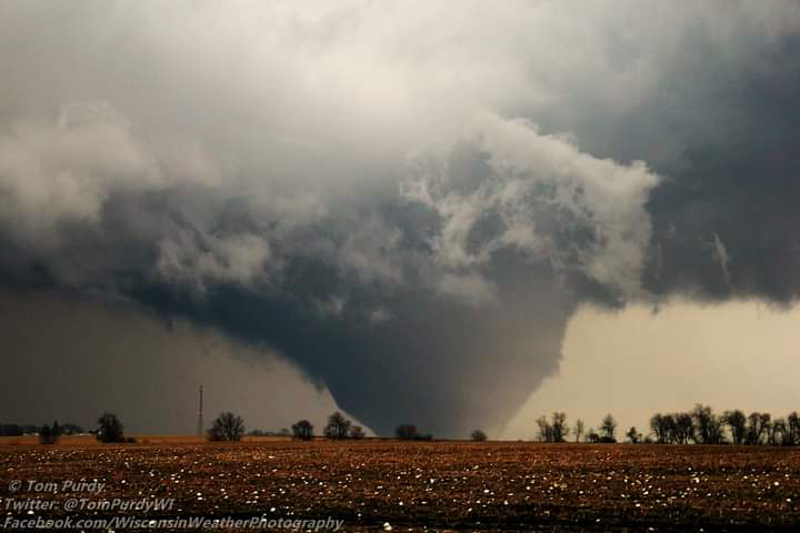
An EF-4 tornado moves across the landscape in northern Illinois. According to storm chaser Tom Purdy’s Twitter account, the photo was taken six years ago. Purdy wrote: “I can’t explain what it was like watching this in pretty much my own backyard.” Purdy lives in Janesville.
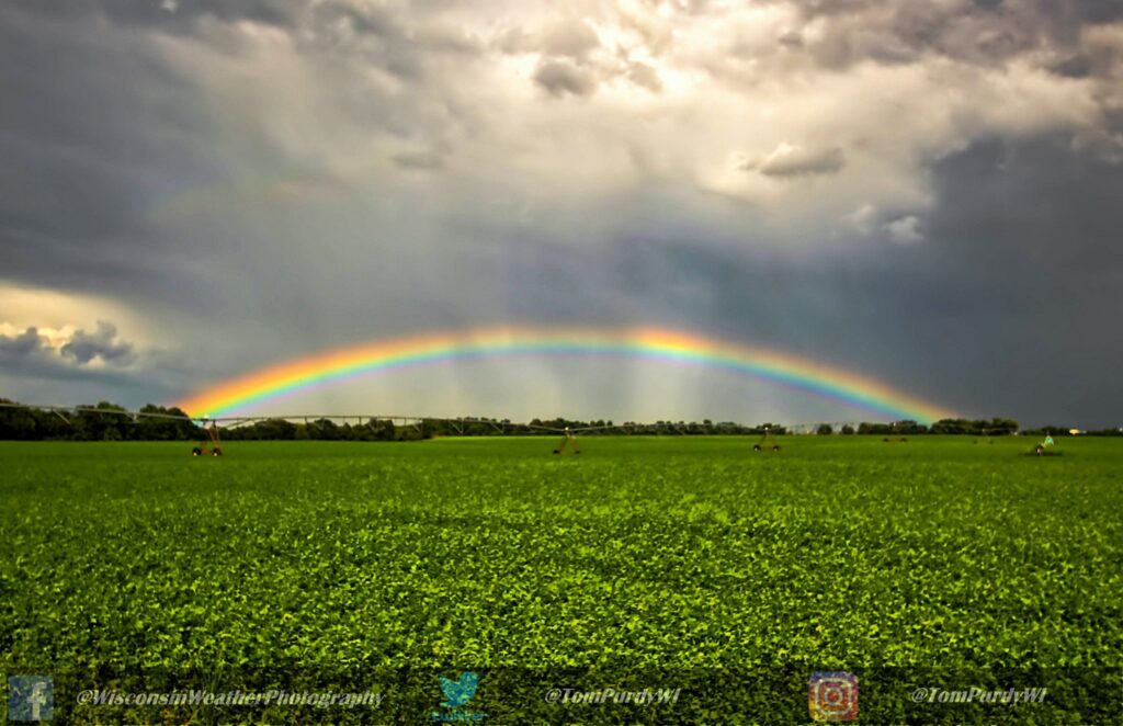
A rainbow spans a field in southern Wisconsin. The photo was taken in August of 2019, at which time, storm chaser Tom Purdy wrote on his Twitter account: “one of the brightest low angle rainbows I have ever seen along with crepuscular rays as storms moved through southern Wisconsin.”
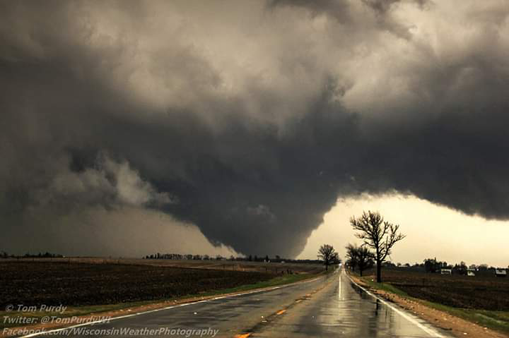
An EF-4 tornado crosses a road in Rochelle, Ill. Storm chaser Tom Purdy said the photo was among his favorites taken over the last decade.
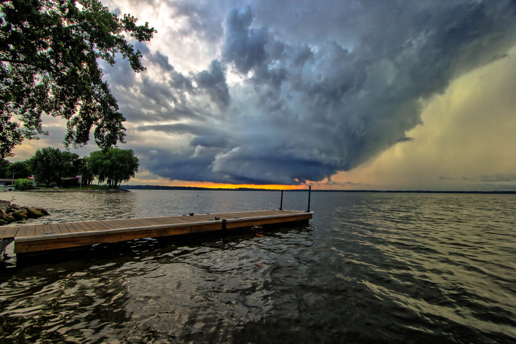
A supercell with rotating wall cloud crosses Lake Koshkonong. Storm chaser Tom Purdy described the photograph as one of his favorites captured over the last decade.
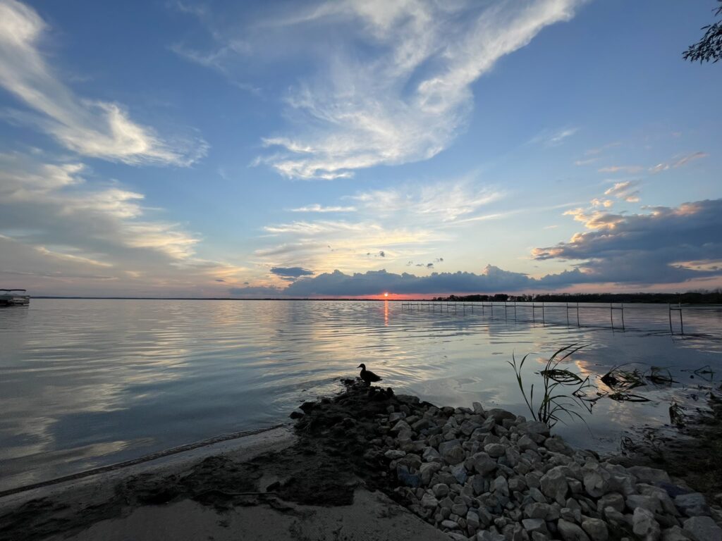
Sunset over Lake Koshkonong taken in June of this year.
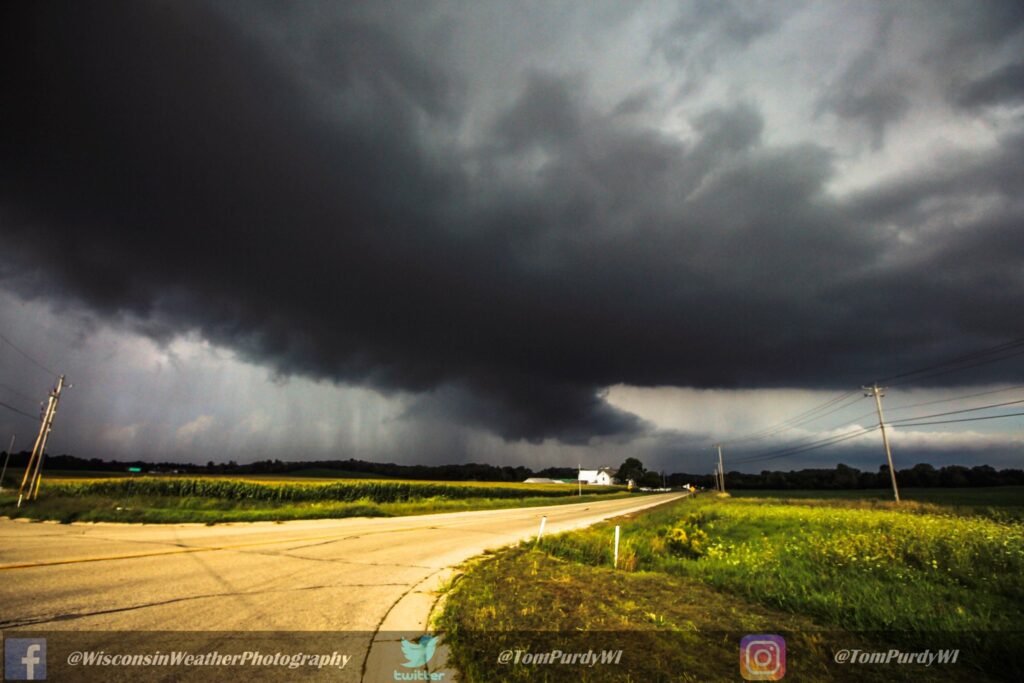
Captured near Dousman in September of 2019, storm chaser Tom Purdy wrote on his Twitter account: “a wall cloud with decent inflow, unfortunately storm just kept getting ripped apart in the upper levels.”

Storm chaser Tom Purdy, while interviewing Sunday with Fort Atkinson Online, enjoys a warm and breezy day at the Lakeview Bar and Grill beach on Lake Koshkonong. Describing the day as “normal people’s weather,” he said, for him, it’s somewhat boring. Kim McDarison photo.
This post has already been read 3678 times!